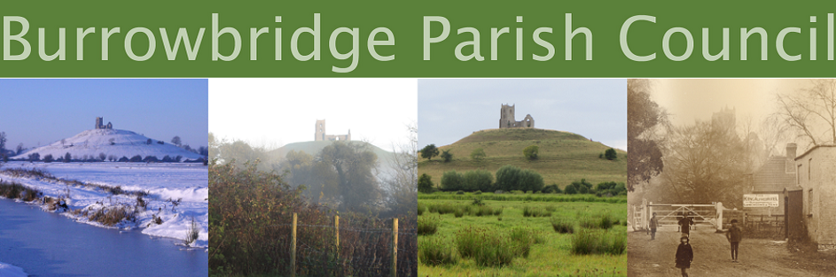
Burrow Mump
Burrow Mump is a natural outcrop of Keuper Marl standing near the strategic point where the River Tone and the old course of the River Cary join the River Parrett.

It is about 100 feet high and was given to the National trust in 1946 by Major AC Barrett as a war memorial.
It probably served as a natural outwork to the defended royal island of Athelney at the end of the 9th century. A chapel dedicated to St Michael and belonging to Athelney Abbey stood on its summit before the middle of the 13th century but was rebuilt several times after that.
 In 1793 the attempt at total rebuilding on a smaller scale ended in failure to collect enough money, and a church for the community was built instead at the foot of the hill in 1838.
A square earthwork part way down from the summit indicates that the Mump had military significance. It was garrisoned by Royalist forces in 1642 and 1645 during the Civil War, and a detachment of the king’s army occupied it in 1685 during the course of Monmouth’s Rebellion.
There were four shops below the hill in 1539, all belonging to Athelney Abbey, and a wharf operated there until the mid 19th century for coal and other heavy goods. There was an inn by 1657 which in 1686 had 8 beds and stabling for 16 horses. It has been known as the Anchor, the Burrow inn, the Bell, and since 1806 as the King Alfred.


